Room Four
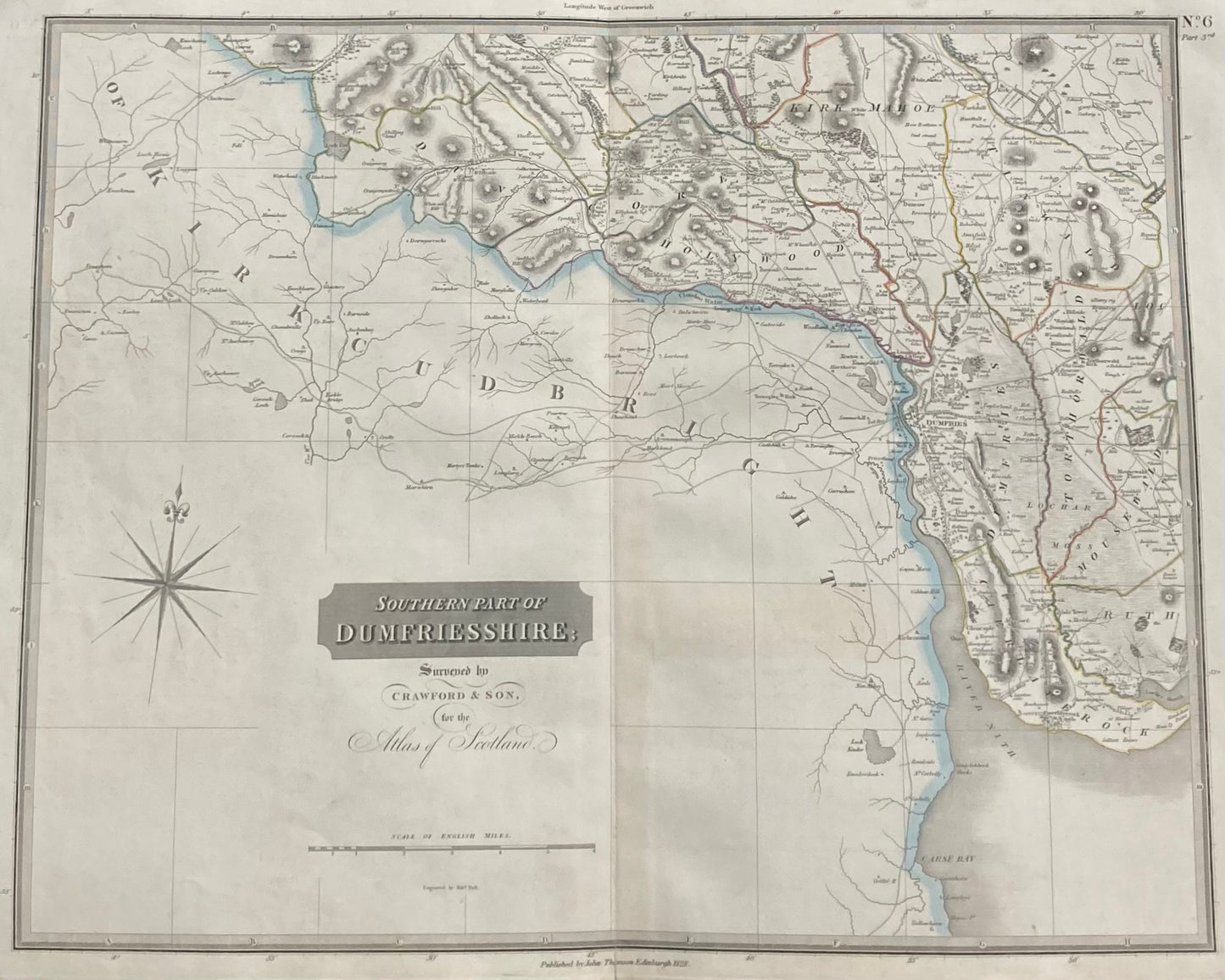
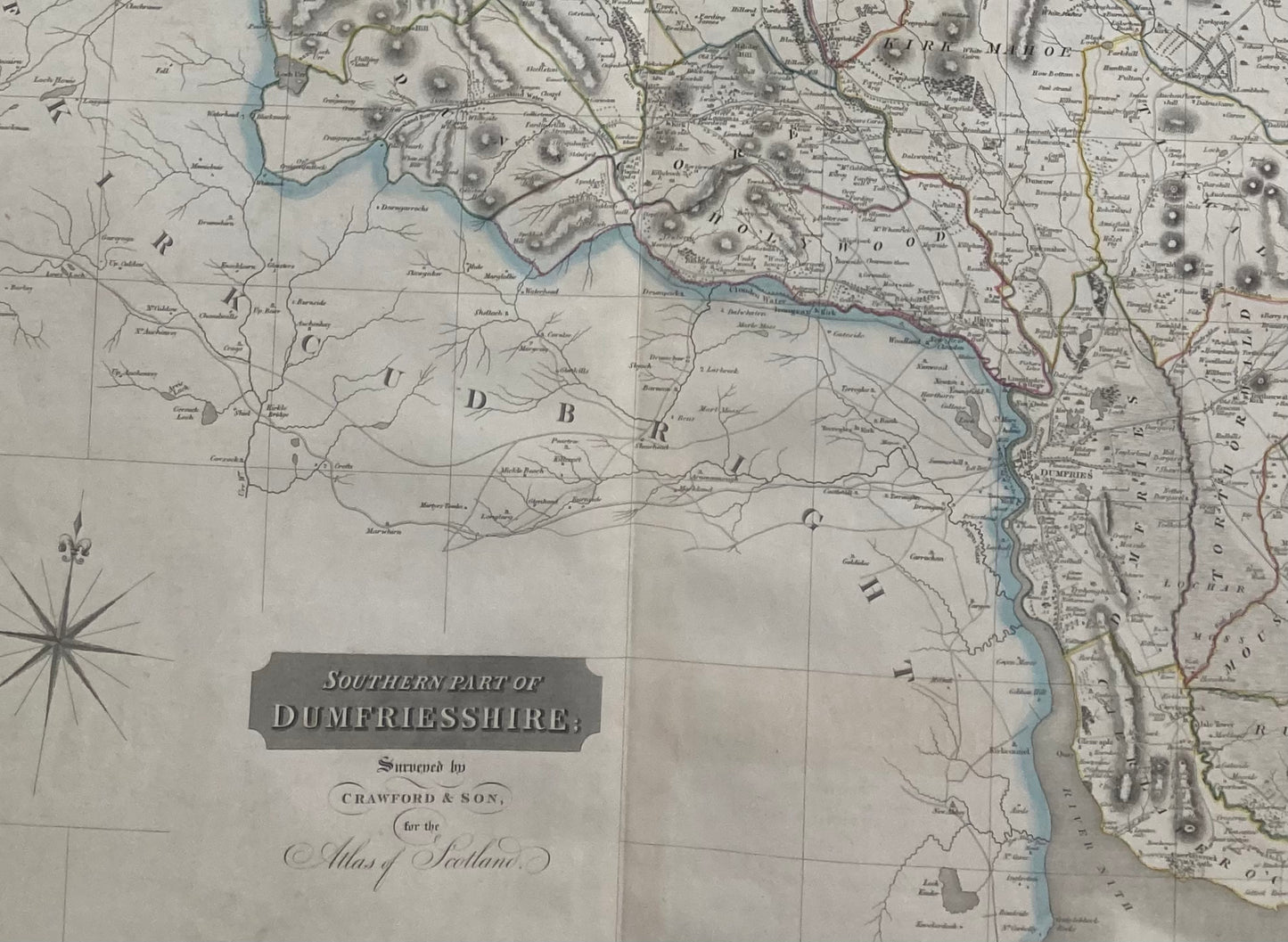
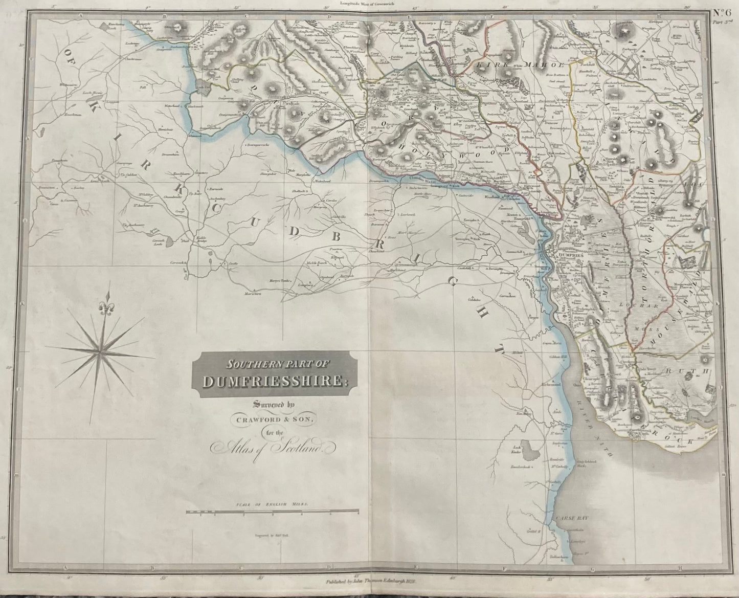
Antique Map, Southern Dumfriesshire, Scotland 1828, part 3rd
Antique Map, Southern Dumfriesshire, Scotland 1828, part 3rd
No se pudo cargar la disponibilidad de retiro
Southern Part of Dumfriesshire, Scotland – Original 1828 Antique Map by John Thomson
A large original antique map of the Southern Part of Dumfriesshire, Scotland, published by John Thomson & Co., Edinburgh for the renowned “Atlas of Scotland” .
This beautifully engraved and hand-coloured county map captures the detailed geography and settlements of northern Dumfriesshire and surrounding shires of Peebles, Selkirk and Roxburgh.
-
Date: 1828
-
Mapmaker: John Thomson & Co., Edinburgh
-
Title: Southern Part of Dumfriesshire (Sheet No6. part 3rd)
-
Source: Atlas of Scotland
-
Technique: Engraving, hand-coloured in outline
-
Dimensions: Approx. 28.5 x 21 inches (725mm x 535mm)
Condition: Good overall, a strong, clean impression — ideal for framing or collection.
A fine and genuine example of early 19th-century Scottish cartography, perfect for collectors, historians, or as a decorative antique map for the home or office.
SKU: 1723
Compartir